 MOUNTAIN HIGH MAPS® 4.0 is a major upgrade of our MacUser Eddy Award winning professional mapmaking resource. These detailed and accurate relief views of the world's continents countries and ocean floors have an extensive range of applications: advertising, newspaper & television, publication & presentation, education & reference, multimedia, web & video use. MOUNTAIN HIGH MAPS® Version 4.0 comprises:
 7 versions of each map, 3 pre-colorized - one political and two vegetation & elevation physical maps - in addition to two base grayscale files, plus editable vector maps in Illustrator EPS.
Easier-to-use closed and pre-filled Illustrator - editable and selectable layers.
Over 16,000 updated place names and labeled physical features including rivers, lakes, cities, countries and mountains.
Wide selection of masks enable you to colorize or extract each country (states and provinces on some maps) and define
their borders, highlight coastlines and add dramatic 3-D effects with land mass, coastal shadows or vignette masks.
7,500 map files with over 10 Gb of uncompressed files.
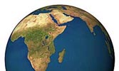
54 stunning, high-resolution globe views (15 of which are fully colorized) showing land relief with land/ocean masks.
Between 100 and 1000 meters per pixel, 300 dpi resolution for high quality imagesetter output and 72 dpi for Web use.
Reproduction rights granted with your purchase of MOUNTAIN HIGH MAPS® allow almost unlimited commercial use.
MOUNTAIN HIGH MAPS® includes all the FRONTIERS Illustrator vector maps described below.
Complete collection: $95 - Individual map packages (EPS & Relief JPEG) $19
Complete Collection Download |
Product Information |
Technical Specifications |
Map Catalog |
Download Individual Map Orders

 MOUNTAIN HIGH MAPS® - CONTINENTAL EDITIONS - Version 4.0
The unique MOUNTAIN HIGH MAPS® collection of relief maps is available as separate products for the designer who only requires a smaller selected group of Continental maps or World / Globe Views for Mac or Windows. The map specifications are identical as for the full Mountain High Maps Edition, including both bitmap JPEG and TIFF Photoshop images along with vector EPS files. All products include the Frontiers vector and paths material.
MOUNTAIN HIGH MAPS® - CONTINENTAL EDITIONS - Version 4.0
The unique MOUNTAIN HIGH MAPS® collection of relief maps is available as separate products for the designer who only requires a smaller selected group of Continental maps or World / Globe Views for Mac or Windows. The map specifications are identical as for the full Mountain High Maps Edition, including both bitmap JPEG and TIFF Photoshop images along with vector EPS files. All products include the Frontiers vector and paths material.
Africa collection of 8 maps $29 Buy Now
America collection of 16 maps $29 Buy Now
Asia collection of 13 maps $29 Buy Now
Australia collection of 4 maps $29 Buy Now
Europe collection of 23 maps $29 Buy Now
World Views collection of 14 maps $29 Buy Now
Globes collection of 8 maps $29 Buy Now
Continental Edition Content & Information |
Technical Specifications |
MHM Map Catalog
 MOUNTAIN HIGH MAP FRONTIERS Version 4.0 is a collection of high quality editable outline maps. This superb resource of 78 map views covers the world and consists of coastline, borders, rivers, city locations and longitude/latitude graticules to fit the MOUNTAIN HIGH MAPS® relief map images or can be used independently as a self-contained resource. Each map is available in three formats: Adobe Illustrator(EPS2. Rights allow almost unlimited commercial use.
Complete Collection: $39 - Individual maps for download $9.
Product Information |
Technical Specifications |
Catalog |
Individual Map Downloads |
Frontiers Collection Download
 MOUNTAIN HIGH MAPS® USA RELIEF - Digital Topo and EPS Geo-Political Maps of the USA states.
MHM USA RELIEF is a set of 4 full color shaded relief maps and one grayscale relief map sized between 50-500 MB at 100 meter per pixel resolution. Any of the five interchangeable topographic base relief maps (high-contrast, low-contract, natural look, cartographic and grayscale styles) can be overlayed with an editable EPS vector data including coastlines, rivers, interstate / major roads, railroads, county, state and international borders, town locations, town names text and latitude/longitude grids.
MOUNTAIN HIGH MAPS® USA RELIEF 100 meter resolution JPEG Relief & EPS Geopolitical maps ordering options:
The Eastern USA collection 31 states Price $49.
The Western USA collection 19 states Price $49.
Each state sold separately Price $19 - EPS only $9
Collection of 50 EPS states Price $29.
Product Information |
Technical Specifications |
Catalog |
Download EPS Maps
Download Individual State Map Packages
CUSTOM MAPPING - Check www.custom-map.com for prompt quotes on any special map project or item not shown here!
 EARTH IMAGES COLLECTION is a collection of 3D globe views and maps created from Planetary Visions Satellite Imagemap, a highly realistic image of the Earth's surface derived from thousands of Earth observation satellite images. Data from 3 satellite systems were combined with digital map and terrain data to produce the natural color Satellite Imagemap. Earth-Images comprises 8 variations of Globe Views - Clouds, Clear sky, Night Sky and Ocean floor texture, all with the optional white background or black background - 1,179 total images at 5,000 meters per pixel resolution. Also included a selection of world views focused on 3 different areas in 3 styles, and a collection of Continental Views taken from 6 locations in 3 styles each. For details see www.earth-images.com EARTH IMAGES COLLECTION - -Price $19 Product Information |
Technical Specifications |
Map Catalog |
Buy Now
EARTH IMAGES COLLECTION is a collection of 3D globe views and maps created from Planetary Visions Satellite Imagemap, a highly realistic image of the Earth's surface derived from thousands of Earth observation satellite images. Data from 3 satellite systems were combined with digital map and terrain data to produce the natural color Satellite Imagemap. Earth-Images comprises 8 variations of Globe Views - Clouds, Clear sky, Night Sky and Ocean floor texture, all with the optional white background or black background - 1,179 total images at 5,000 meters per pixel resolution. Also included a selection of world views focused on 3 different areas in 3 styles, and a collection of Continental Views taken from 6 locations in 3 styles each. For details see www.earth-images.com EARTH IMAGES COLLECTION - -Price $19 Product Information |
Technical Specifications |
Map Catalog |
Buy Now
 GLOBESHOTS® is a distinctive collection of high quality relief globe images with enhanced 3D effect. This superb resource of 100 high resolution (300 dpi) TIFF RGB and 164 low resolution (72 dpi) PICT/BMP colorized globes show the world in 5 general categories and 39 specific viewpoints - equatorial, polar, strategic, oceanic and continental. The Relief Globes are presented in a range of styles and colors, with and without cloud cover, with masks and artwork to reconfigure the globes with interchangeable foregrounds and backgrounds, including blends, halo and star effects. Masks are provided to remove the globes from their background and provide shading effects. To view the complete catalog of globes and review product information and licensing details see www.globe-world.com
GLOBESHOTS® Complete collection
GLOBESHOTS® is a distinctive collection of high quality relief globe images with enhanced 3D effect. This superb resource of 100 high resolution (300 dpi) TIFF RGB and 164 low resolution (72 dpi) PICT/BMP colorized globes show the world in 5 general categories and 39 specific viewpoints - equatorial, polar, strategic, oceanic and continental. The Relief Globes are presented in a range of styles and colors, with and without cloud cover, with masks and artwork to reconfigure the globes with interchangeable foregrounds and backgrounds, including blends, halo and star effects. Masks are provided to remove the globes from their background and provide shading effects. To view the complete catalog of globes and review product information and licensing details see www.globe-world.com
GLOBESHOTS® Complete collection ITEM 0076 - $19
Product Information |
Tech Specifications |
Catalog|
Download Individual Globe |
Download Complete Globe Collection
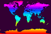
 EARTHSHOTS® is a distinctive library of full color World relief maps of our planet's continents and ocean floors. 250 world view variations featuring political and topographical themes including, climate, vegetation, living standards and population. EARTHSHOTS is suitable for paper or electronic media publishing applications, print, multimedia, broadcast and DTP map graphics. The image library is JPEG format, 14 Mb decompressed and 300 dpi.
EARTHSHOTS® World 604 - $19
 Product Information | Technical Specifications | Catalog
Download EarthShots Collection
EARTHSHOTS® + FRONTIER WORLD MAP Combo set- $29
includes MOUNTAIN HIGH MAP #604 WORLD EPS MAP (see product above) for full editing and customization
includes World Map using Frontiers masks and layered EPS vector map
Download EarthShots+Frontiers Collection
 COOLMAPS® collection of 250 ready-to-use royalty-free world maps, each volume created specially by a team of graphic designers, featuring an imaginative array of dazzling and dramatic maps suitable for many media publishing applications. Rights allow almost unlimited commercial use. CoolMaps Overview Product Information
COOLMAPS® Volume 1.1 - World Maps Vector EPS $19
Technical Specifications | Catalog |
Buy Now
COOLMAPS® Volume 1.2 - World Maps Bitmap JPEG $19
Technical Specifications | Catalog |
Buy Now
COOLMAPS USA Volume 2.2 - USA Maps Bitmap JPEG $19
Technical Specifications | Catalog |
Buy Now
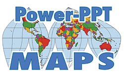
POWERPOINT MAPS Digital Wisdom’s collection of Mountain High Maps for PowerPoint® Presentations is available for Buy Now. Each set of maps is delivered as a Microsoft PowerPoint® PPT format file and can be easily and speedily edited within PowerPoint® application to create a map with a wide number of impressive variations to meet your presentation needs. Options are available for individual PPT maps, elevation relief, vegetation relief and political color fill versions, or a bundle of all three versions. Go to Map Catalog to view download options.
PPT MAPS PowerPoint Maps - Download Only $9 each
Product Information |
Catalog |
User Guide |
Download Individual PPT Maps
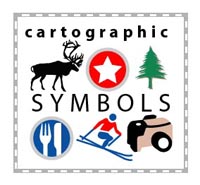
MAP SYMBOLS The Digital Wisdom cartographic symbol library provide graphic artists and mapmakers with a complete, well-designed contemporary set of map symbols packaged into an Illustrator vector library covering most of the features that need symbolizing on a map. Each library contains point, line and area symbols (including colors and patterns) which are fully editable and scalable. The design of each and every symbol has been very carefully thought through to allow intuitive recognition of the main features of a map and use a minimal footprint to cut down on map clutter. These beautifully designed point, line and area symbols and color sets for Illustrator are compatible with their earlier versions wherever possible, but also recognizing that a higher level of cartographic presentation, quality and efficiency possible with Illustrator 10 should be a key feature. This allows the definition of points and symbols to a higher level, depicting the purpose and function of a wide range of activities, specifically geared towards tourism, travel, orientation, navigation and entertainment.
MAP SYMBOLS Map Symbols for Illustrator - Download Only $9 complete collection
Product Information & Catalog |
Collection of Symbols |
Buy Now
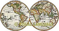 ANTIQUE MAPS OF THE WORLD is a comprehensive five CD-ROM library of images which encapsulate the discoveries of five centuries of antique maps, celestial charts and illustrations, cartographic motifs and more. With these stunning antique art maps, designers, artists, publishers, and graphics professionals can use history's best visual communications to convey a message today. See www.antique-map.net for more details.
ANTIQUE MAPS OF THE WORLD has 5 collections:
Antique Maps of the World: 1520-1680
Catalog Vol.1 - $49;
Antique Maps of the World: 1680-1898
Catalog Vol.2 - $49;
Antique Celestial Charts and Illustrations: 1680-1880 -
Catalog Vol.3 - $49;
Extraordinary Cartographic Motifs
Catalog Vol.4 - $49;
Antique Maps of the Continents and Regions
Catalog Vol.5 - $49;
Product Information |
Technical Specifications
 FLAGS OF THE WORLD - Professional Quality Postscript National Flags contains over 375 editable full color EPS international flags representing countries and organizations, including Historic flags, old flag versions, Naval flags, Warning flags, International Numeral & Alphabet flags. Flags are high quality with the very latest national flag changes plus optional emblems - see www.world-flags.net for a complete list of the flags and a downloadable view catalog. This product is also available for Buy Now.
FLAGS OF THE WORLD Mac/Win $9 complete collection
Product Information |
Catalog|
Buy Now
 US STATE FLAGS - US State Flags is an Encapsulated Postscript (EPS) collection of 50 full-color US State flags representing states throughout the US. US State Flags collection also contains additional flags, including 35 Current and Historical USA flags, and 7 District and Territory Flags. Each flag is full color and drawn to the highest detail to insure superior reproduction quality at large or small sizes. For full details see www.state-flags.us. Macintosh and Windows files are provided in EPS format. Product is available for Buy Now.
UNITED STATES STATE FLAGS Mac/Win $9 complete collection
Product Information |
Catalog | Buy Now
Digital Wisdom Inc.
USA & Canada orders: 800-800-8560 - International orders: 804-443-9000